Phoenix Drone Pros
Blog
See the top benefits of aerial property media for real estate, construction, and inspections, from stronger marketing to safer, faster decisions.
A ground-level photo can make a property look smaller, busier, and harder to understand than it really is. That gap matters when you are trying to sell a home, lease commercial space, document a jobsite, or inspect a roof without wasting time. The top benefits of aerial property media come down to one thing - it gives decision-makers a clearer view of the asset, the site, and the surrounding context.
For property professionals, that clarity is not just cosmetic. It affects how fast listings move, how confidently buyers evaluate a site, how accurately teams track progress, and how safely owners assess hard-to-reach areas. Aerial media works because it shows what standard photography often misses.
Why aerial property media changes the conversation
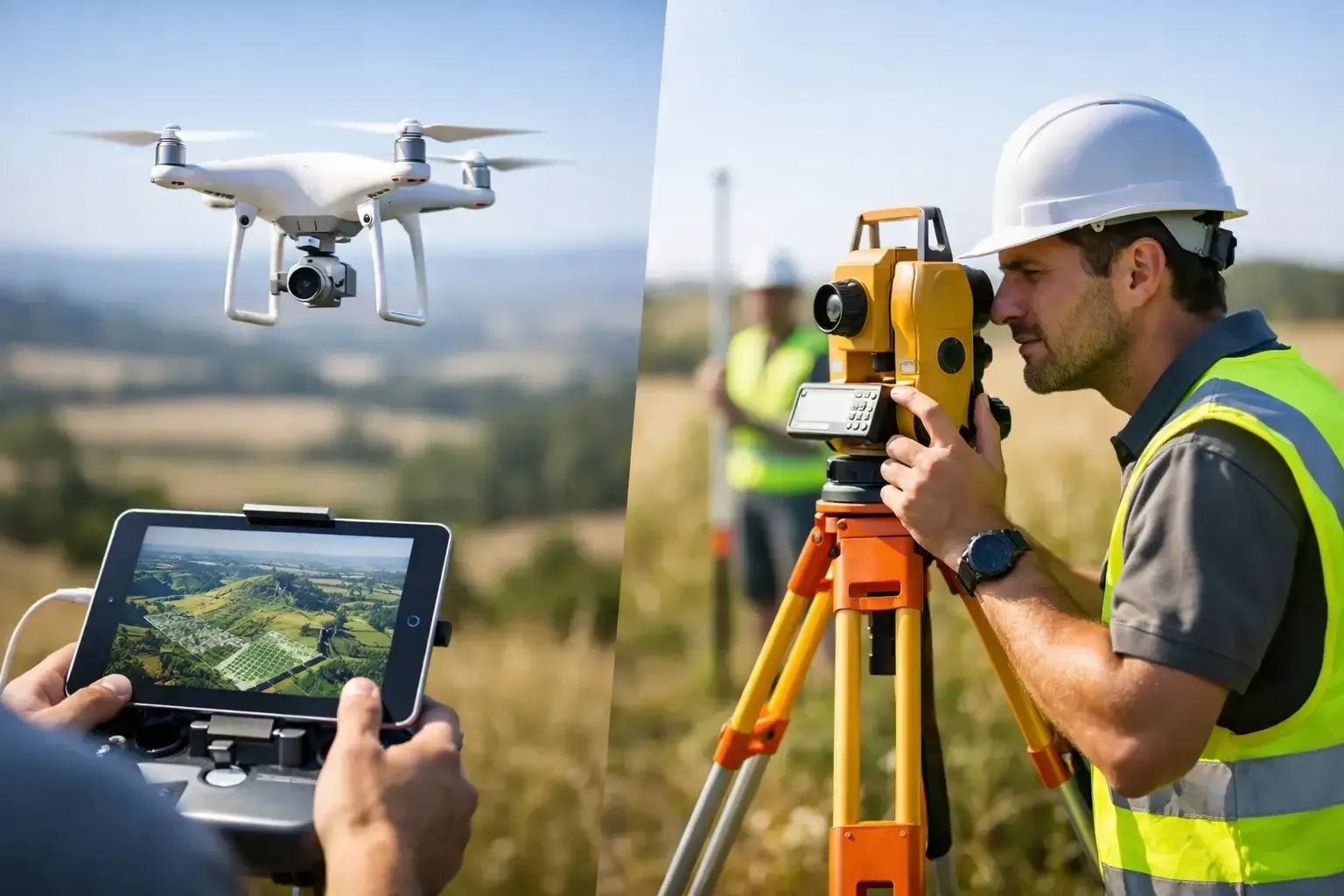
Most property decisions involve more than the building itself. Buyers want to understand lot size, access roads, parking layout, neighboring uses, visibility from major streets, and how improvements sit on the land. Developers and contractors need current visuals that show grading, staging, structure progress, and site logistics. Owners and managers often need a closer look at roofs, drainage paths, and exterior conditions without sending someone into a risky position.
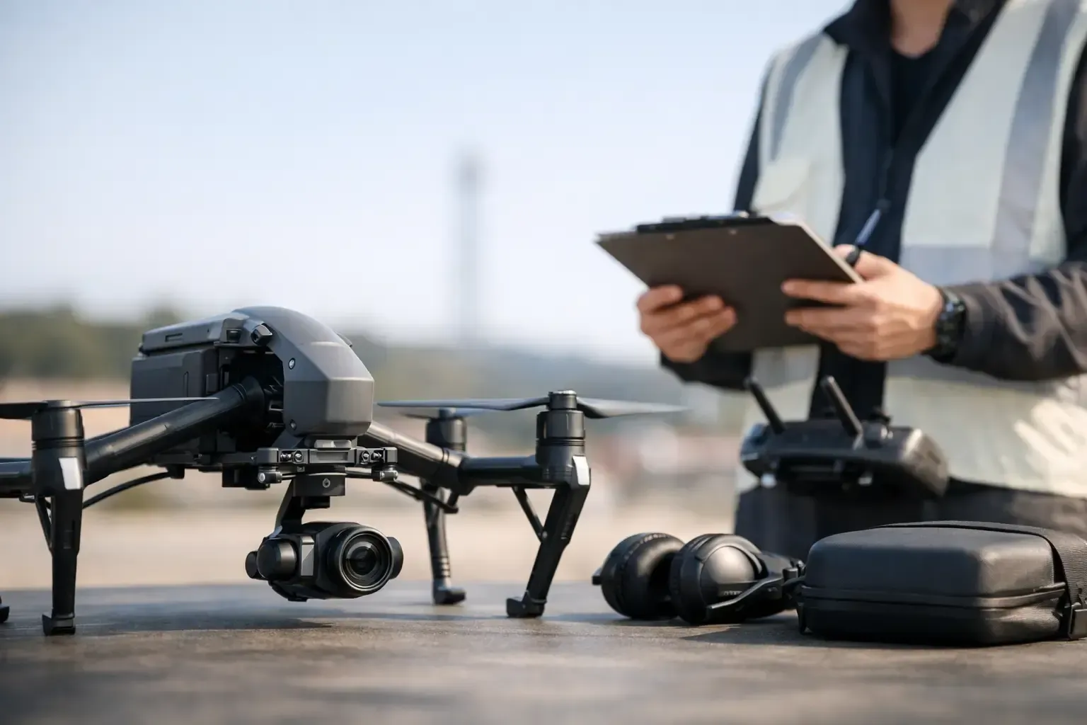
That is where aerial media becomes useful, not flashy. It adds perspective that supports marketing, planning, documentation, and inspection. When the flight is handled by an FAA-certified, insured operator with experience in active jobsites and controlled airspace, the result is not just better footage. It is more reliable information.
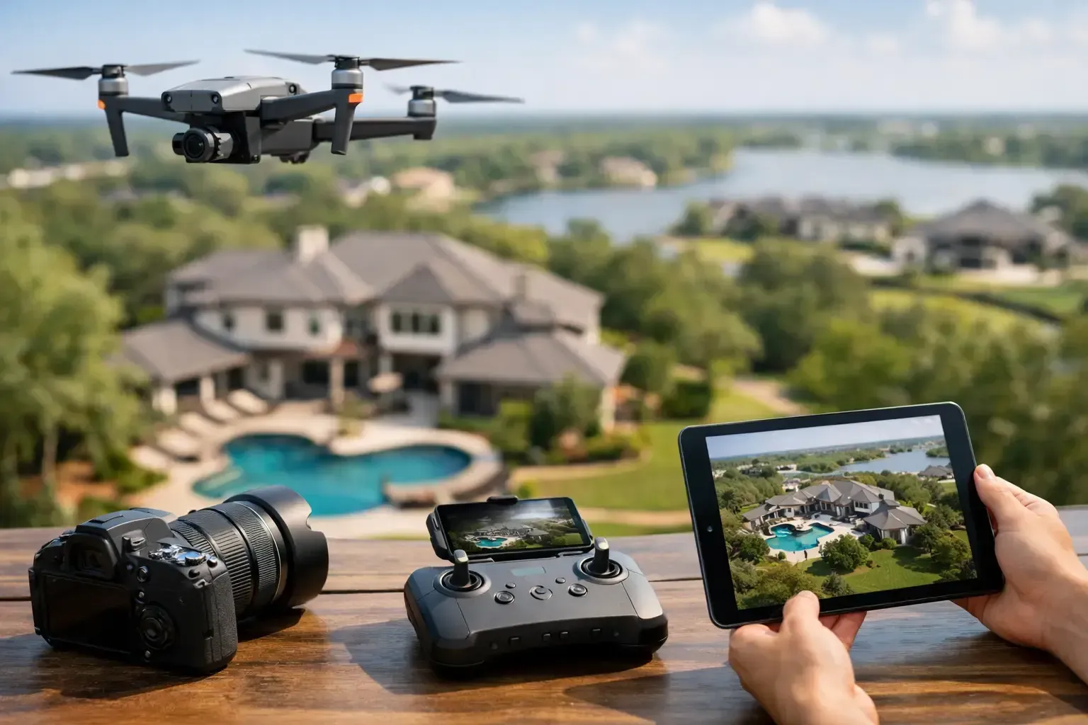
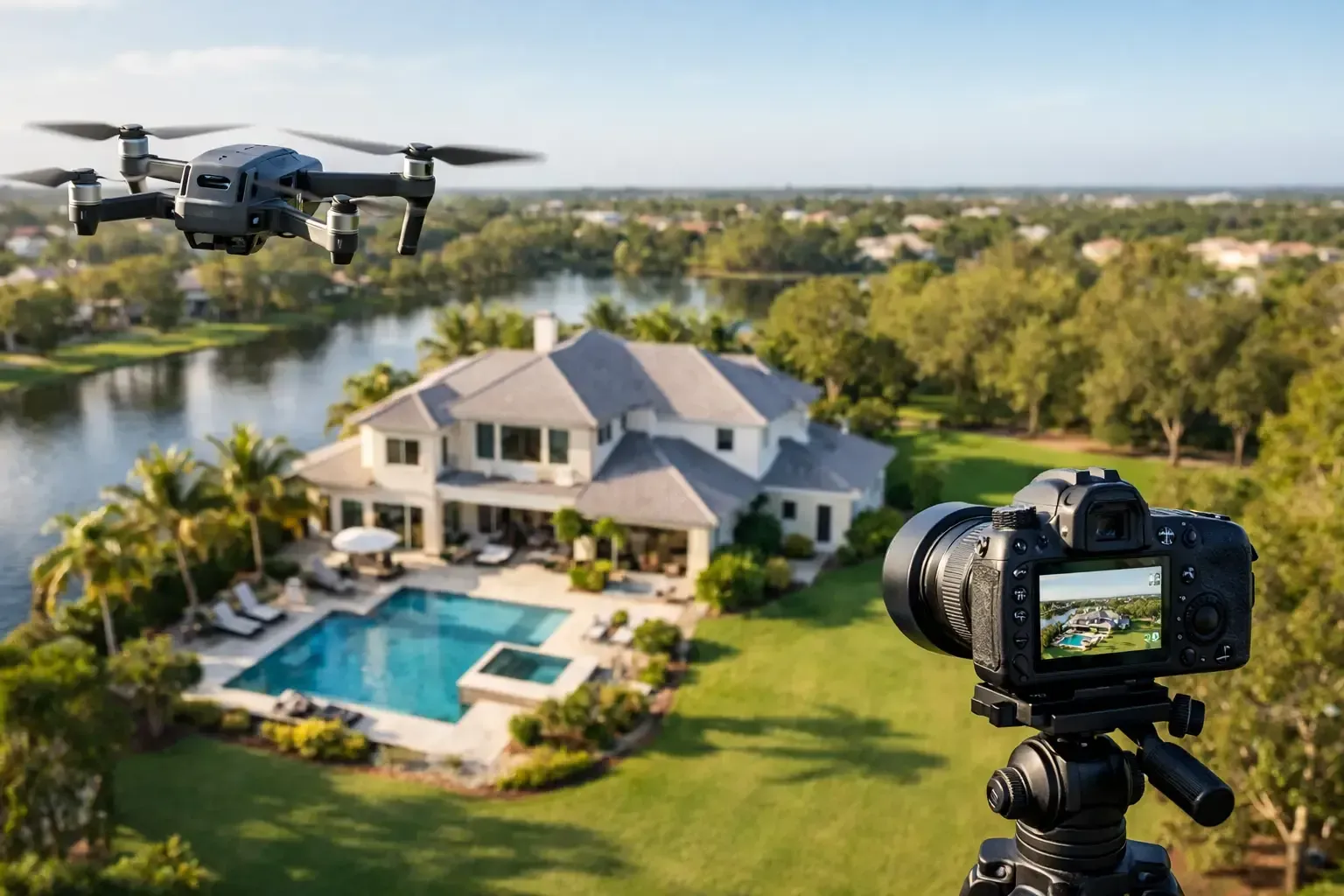
1. Stronger property marketing with real context
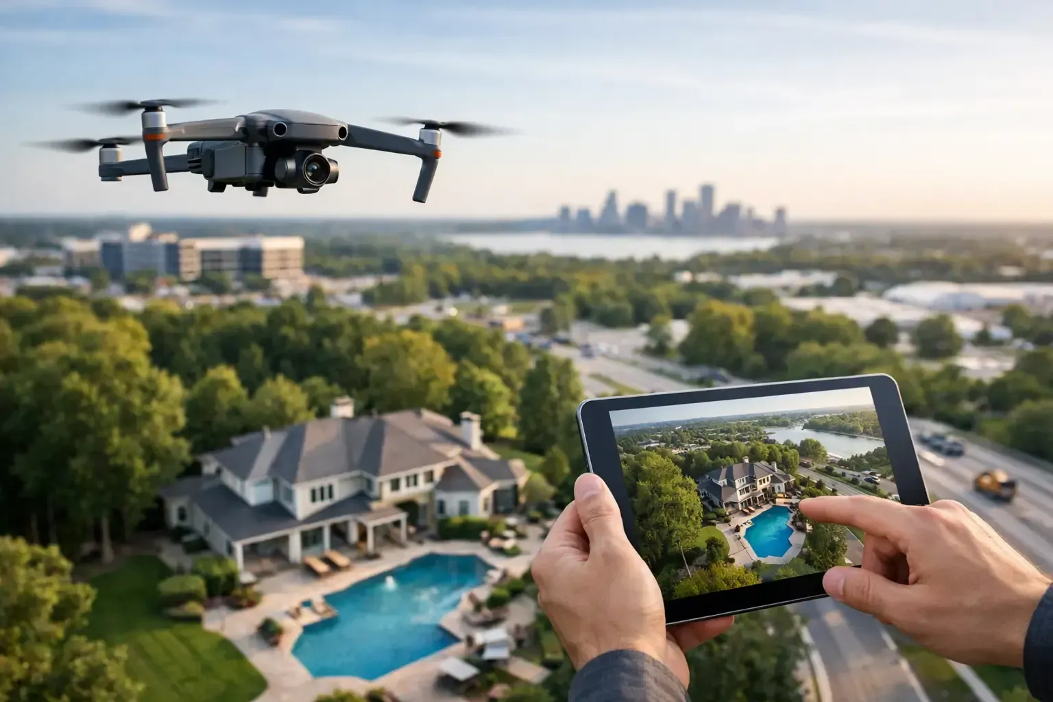
One of the top benefits of aerial property media is that it helps people understand a property faster. Aerial photos and video show the full footprint, setbacks, landscaping, parking, outbuildings, and adjacency in a single frame. For residential listings, that can make a larger lot, pool area, backing wash, mountain view, or corner placement much easier to appreciate. For commercial assets, it can highlight frontage, traffic patterns, truck access, shared parking, and nearby retailers.
This matters because buyers and tenants do not evaluate property in isolation. They evaluate usability, location, and surrounding value. Ground photography still plays an important role, but aerial content fills in the missing context that often drives interest.
There is a trade-off here. Not every property needs a dramatic cinematic package. A modest residential lot in a dense neighborhood may benefit more from a few clean overheads than from a long edited video. The point is not to overshoot. It is to match the media to the asset and the audience.
2. Better listing performance and more qualified interest
Aerial visuals tend to improve the first impression of a listing because they answer buyer questions before a showing is scheduled. When prospects can already see the lot lines, access, nearby amenities, and overall site layout, they are less likely to waste time on a property that is not a fit. That can lead to more qualified inquiries and more productive tours.
For agents and brokers, this is practical value. Better media can support stronger online engagement, but the bigger win is often efficiency. Serious buyers come in with a more accurate understanding of the property. That reduces confusion and helps conversations move toward the real decision points.
Commercial marketing benefits even more from this. Investors, tenants, and out-of-market buyers often start with remote evaluation. Aerial property media gives them a much faster read on location dynamics and site functionality than standard photo sets alone.
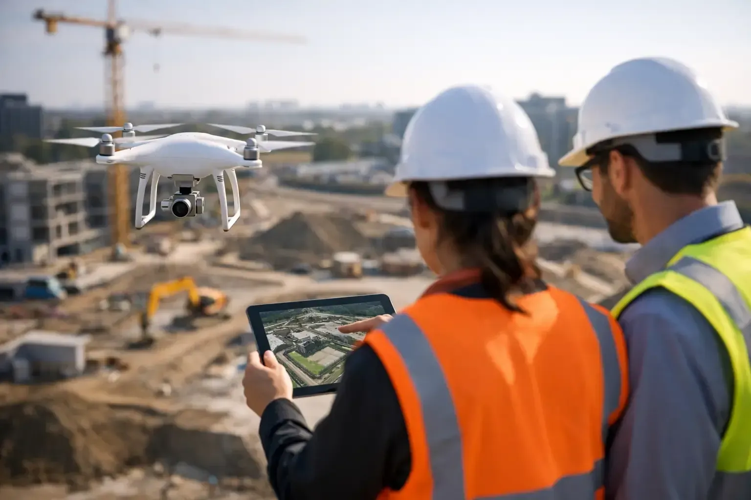
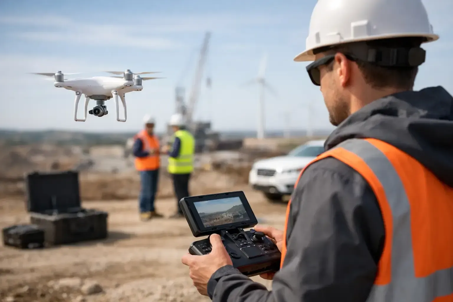
3. Clearer documentation for construction and development
For builders, developers, and project managers, aerial media is not just a marketing tool. It is a documentation tool. Regular drone flights create a visual record of progress across grading, utility work, framing, roofing, paving, and final site conditions. That record helps teams track milestones, communicate with stakeholders, and spot issues early.
Aerial documentation is especially useful on larger sites where walking the full property takes time and where activity changes week to week. A consistent set of overhead images or progress videos can show material staging, traffic flow, drainage changes, equipment positioning, and work completed across multiple areas at once.
The value grows when media is captured on a repeatable schedule. A one-time flight can be useful, but recurring documentation supports reporting, owner updates, lender communication, and internal accountability. It gives everyone a shared visual reference instead of relying on fragmented phone photos from the field.
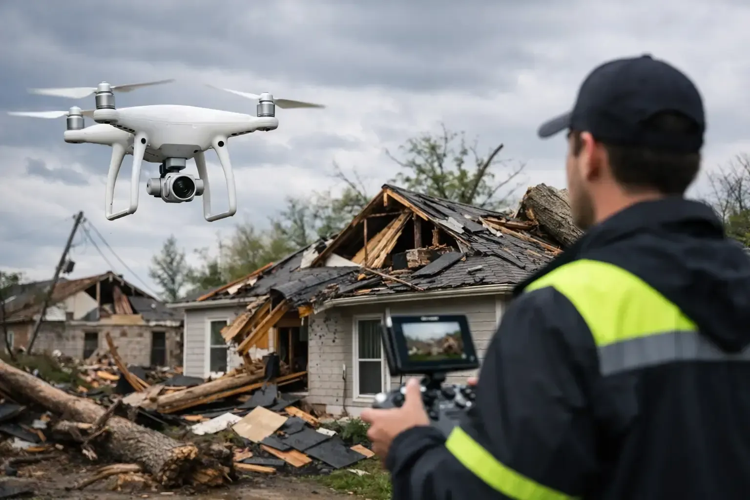
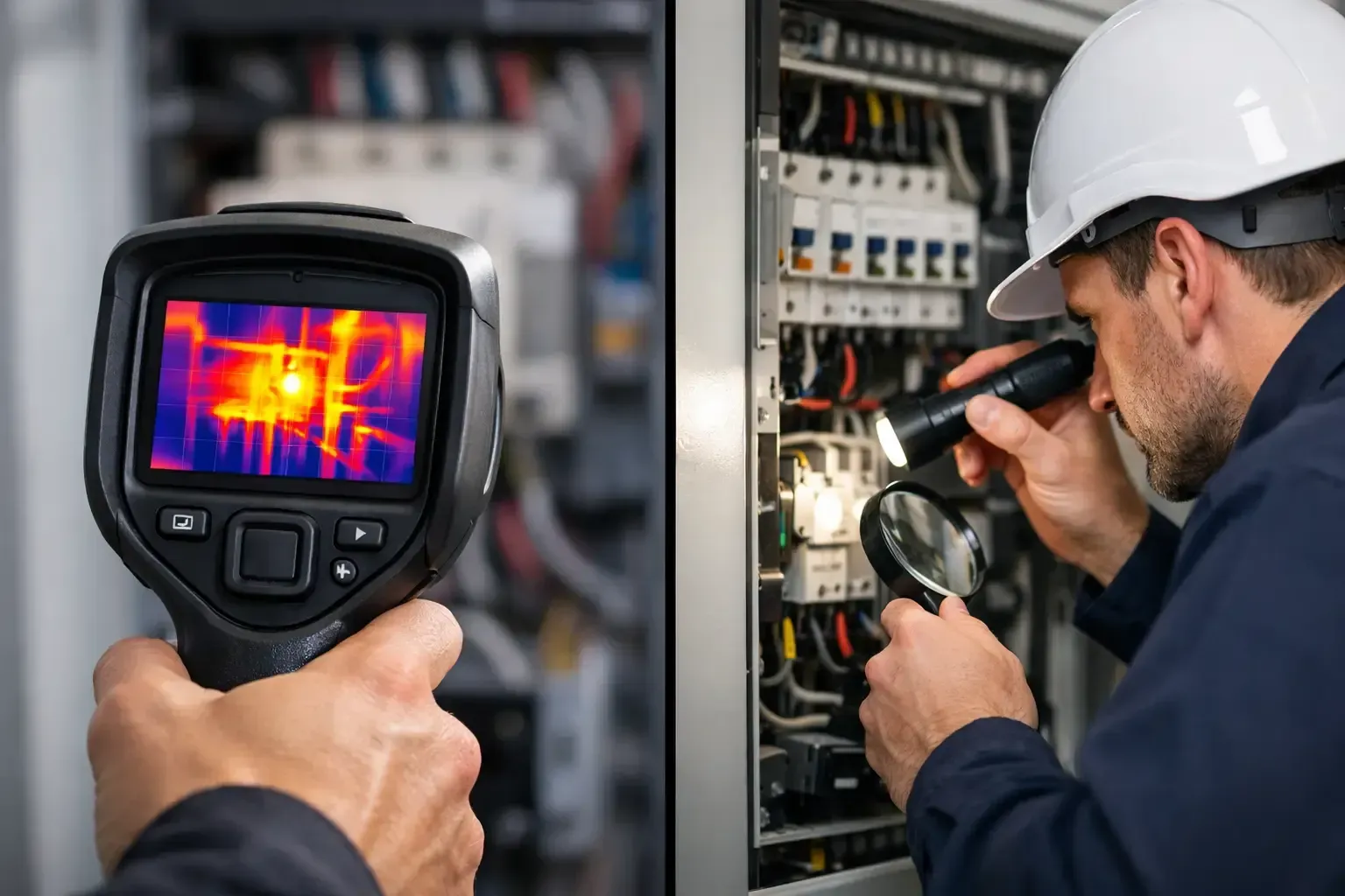
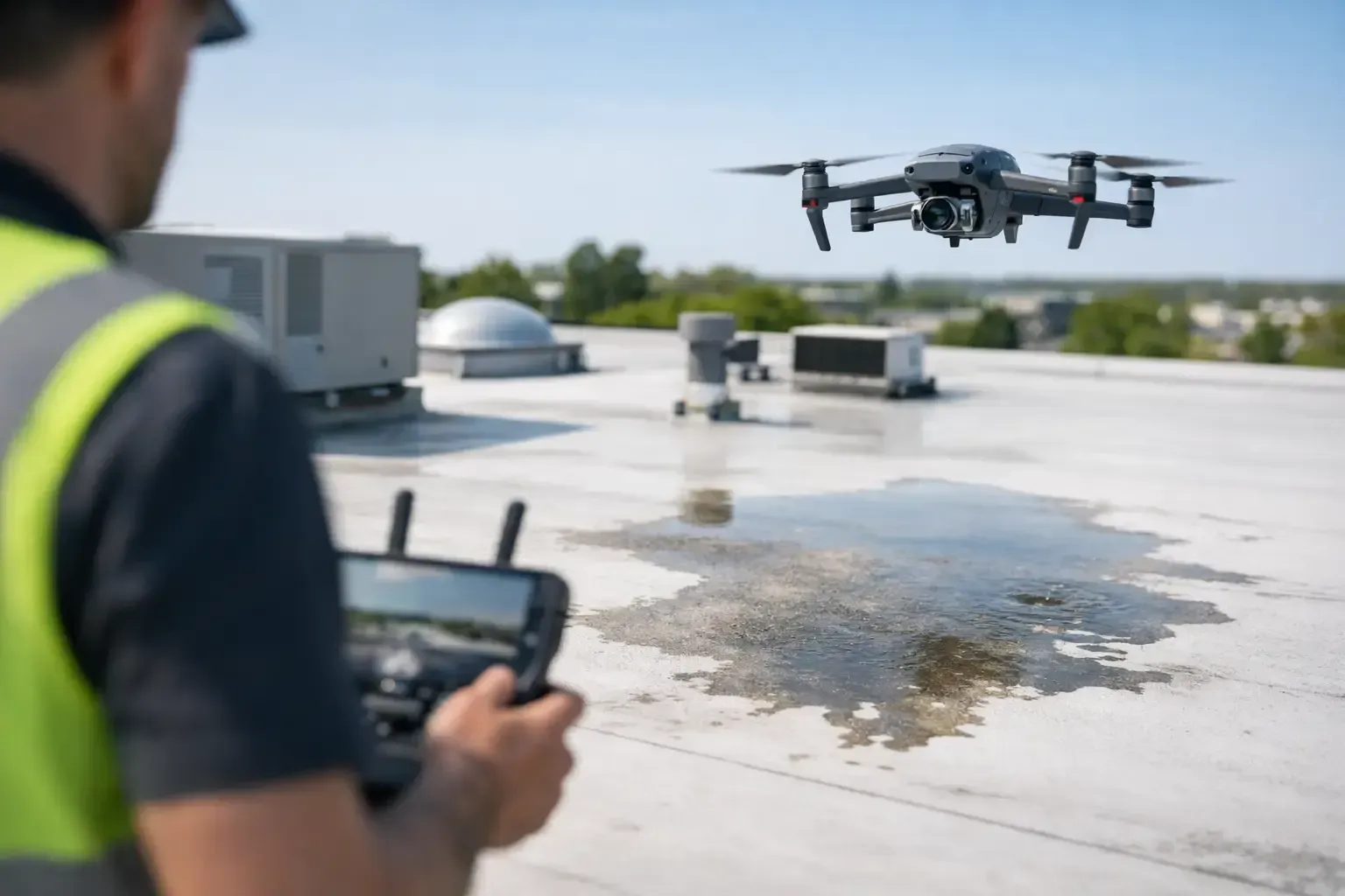
4. Safer access for roofs and elevated structures
Another of the top benefits of aerial property media is safer inspection support. Roofs, upper facades, steeples, HVAC areas, and other elevated assets can be difficult or risky to access manually. A drone can capture high-resolution imagery from multiple angles without putting a person directly on a steep surface or near an edge just to get an initial view.
That does not mean drones replace every hands-on inspection. In some cases, a licensed roofer, engineer, or contractor still needs direct physical access to confirm conditions. But aerial media can significantly reduce unnecessary climbing, improve pre-inspection planning, and document visible issues such as storm damage, ponding areas, cracked tiles, membrane wear, blocked drains, or exterior deterioration.
For owners and managers, that means faster triage. Instead of guessing whether a site visit is urgent, they can review current visuals and make a more informed call.
5. More informed decisions for remote owners and investors
Not every property owner is local. Investors, second-home owners, and commercial stakeholders often need visibility into an asset without being on site. Aerial media helps bridge that gap by showing the full property condition and surrounding environment in a way that standard snapshots cannot.
This is particularly useful in the Southwest, where site features such as drainage channels, desert wash proximity, roof exposure, solar placement, and lot orientation can affect maintenance, development planning, and long-term value. Aerial visuals give remote decision-makers a current, broad view that supports faster approvals and better questions.
It also helps reduce miscommunication between parties. When brokers, owners, contractors, and managers are all working from the same recent visuals, there is less room for vague descriptions and crossed signals.
6. A more accurate view of location advantages
Location is one of the hardest things to communicate with standard property photos. Aerial property media shows how close a site is to highways, retail corridors, schools, green space, industrial access routes, or surrounding employment centers. That broader perspective can be a major advantage when the location itself is part of the value proposition.
For commercial real estate, this is often essential. A warehouse user may care more about truck circulation and freeway access than interior finishes. A retail tenant may want to see visibility from the road and neighboring anchors. A multifamily prospect may respond to proximity to parks, transit, or views. Overhead imagery and video can support those points quickly and credibly.
There is a caveat, though. Good aerial media should clarify, not exaggerate. Overediting or misleading altitude choices can create false expectations. Professional operators understand how to present the property accurately while still making it look its best.
7. Faster turnaround when timing matters
Property timelines are often compressed. Listings need to go live. Storm damage needs to be assessed. Construction stakeholders need updated visuals before a meeting. In those situations, aerial media has another practical advantage - speed.
A well-planned drone session can capture a large amount of visual information in a short window. Instead of coordinating lifts, ladders, or multiple vantage points on foot, an experienced operator can gather broad site coverage efficiently. That speed is even more valuable when the provider understands local flight restrictions, airspace authorization requirements, and active-site safety expectations.
This is where professionalism matters. Fast scheduling only helps if the operation is legal, insured, and reliable. Property owners and project teams need deliverables they can actually use, not footage that creates compliance concerns or misses the important angles.
8. A professional edge in competitive markets
In crowded real estate and development markets, presentation quality affects perception. Clean aerial imagery signals that the property has been marketed thoughtfully and documented professionally. It also reflects well on the agent, broker, developer, or owner behind the project.
That edge is not about looking trendy. It is about reducing friction. People process visual information quickly, and aerial media answers high-value questions upfront. When done well, it helps a property stand out for the right reasons.
For teams working in busy metros or complex operating environments, it also matters who is behind the controls. Phoenix Drone Pros built its reputation on FAA-certified operations, insured flights, and dependable execution for property-focused clients who need quality media and accurate field results without added risk.
When aerial property media delivers the most value
The strongest results come when aerial media is used with a clear purpose. For a luxury residential listing, that purpose may be showing lot size, privacy, and mountain views. For a commercial broker, it may be highlighting frontage and access. For a contractor, it may be creating a repeatable progress archive. For a property owner, it may be checking roof conditions before committing to repairs.
That is why the best projects start with scope, not just equipment. The flight plan, image style, altitude, timing, and deliverables should match the business need. Aerial media is most effective when it is treated as a tool for decision-making, not just an add-on.
If you are responsible for selling, managing, building, or maintaining a property, the real question is simple: what would a better view help you do faster, safer, or with more confidence?