Phoenix Drone Pros
Blog
Search and rescue drone services help teams cover ground faster, spot heat signatures, and improve response decisions in time-critical missions.
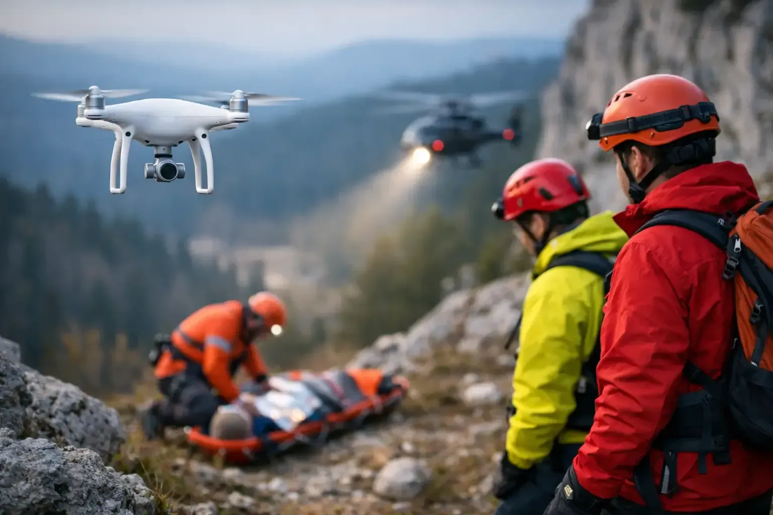
Minutes matter when a search shifts from routine to urgent. In that window, search and rescue drone services can give responders something they rarely have enough of - faster visibility across difficult terrain, low-light conditions, and large search areas.
For public agencies, private teams, property owners, and event operators, the value is straightforward. A drone can get eyes in the air quickly, stream live video, map an area, and in some cases identify heat signatures that would be hard to catch from the ground. That does not replace trained personnel, K9 units, helicopters, or structured incident command. It supports them with faster situational awareness and better information.
What search and rescue drone services actually do
At the operational level, search and rescue drone services are about reducing uncertainty. Instead of sending teams into a wide area with limited visibility, a drone pilot can launch from a safe position and begin scanning terrain, structures, drainage corridors, rooftops, tree lines, open desert, or remote access roads almost immediately.
The right aircraft and payload depend on the mission. Standard visual cameras are useful during daylight searches, scene documentation, and route planning. Thermal sensors become more valuable in low light, early morning, nighttime, or when a subject may be partially obscured by terrain or vegetation. Live video feeds can help command staff adjust deployment in real time rather than waiting for field reports to come back.
This matters in urban and suburban environments as much as it does in remote areas. A missing person search near canals, construction sites, industrial yards, apartment complexes, or undeveloped land presents multiple blind spots. Aerial coverage helps teams rule out zones more efficiently and focus resources where they are most needed.
Why drones are valuable in time-critical searches
The biggest advantage is speed. A properly equipped and legally compliant drone team can arrive, assess the site, and get airborne faster than many traditional aviation options. That speed is often the difference between searching intelligently and simply searching widely.
Coverage is another major benefit. Ground teams are limited by line of sight, access points, fencing, elevation changes, and physical fatigue. A drone can scan over obstacles, check inaccessible sections of a property, and document the search area with a level of consistency that is difficult to match on foot.
Cost is part of the conversation too. Not every mission justifies a helicopter, and not every agency has one available. Drone support gives organizations a practical aerial option for early-stage response, supplemental coverage, and targeted follow-up searches.
That said, drones are not magic. Thermal imaging does not see through walls. Heavy canopy, high ambient temperatures, reflective surfaces, weather, and terrain can all reduce effectiveness. A good operator will explain those limits clearly and adjust the flight plan to the conditions rather than promising more than the technology can deliver.
Thermal imaging in search and rescue drone services
Thermal capability is often what people ask about first, and for good reason. When used correctly, thermal imaging can help operators detect heat signatures from people, vehicles, or recent activity that may not be visible on a standard camera.
In desert environments, timing matters. During the day, sun-heated rocks, pavement, rooftops, and vehicles can create thermal clutter that makes interpretation more difficult. In many cases, early morning, evening, or nighttime operations produce cleaner contrast. That is why experienced operators do not treat thermal as a one-button solution. They use it as one tool among several, often switching between thermal and visual views to confirm what they are seeing.
Thermal is also useful around structures. Large commercial properties, construction sites, storage yards, and residential communities all contain areas that are awkward or time-consuming to inspect from the ground. Aerial thermal scans can help teams prioritize likely locations and avoid wasting time on low-probability zones.
The compliance side matters more than most clients expect
In emergency support work, professionalism is not a marketing detail. It is part of mission success. Drone operations near neighborhoods, roads, active sites, or controlled airspace require a pilot who understands FAA rules, airspace authorization, safety procedures, and how to coordinate without creating new problems.
That is especially relevant in major metro areas where airspace can be more complex. A search may be urgent, but urgency does not remove the need for lawful and safe operations. The right provider brings FAA-certified flight experience, insured operations, clear communication, and the judgment to know when conditions support a launch and when they do not.
This is one reason experienced commercial drone operators are often better suited for support roles than casual pilots with good equipment. Search environments are dynamic. There may be responders on the ground, traffic nearby, low visibility, bystanders, property hazards, and changing weather. Strong flight skills matter, but so do risk assessment and field discipline.
Where these services are most useful
Search and rescue drone services are commonly associated with missing persons, but the use cases are broader than that. They can support post-storm checks, rapid property sweeps, perimeter scans, and emergency response planning when access is restricted or visibility is poor.
For construction managers and property operators, drones can help during incidents involving worker location, unauthorized access, or after-hours site checks across large footprints. For HOAs, ranch properties, and commercial campuses, aerial support can speed up the initial search phase before ground teams commit to a larger operation.
Events also present a practical use case. Large outdoor gatherings, festival grounds, and race venues can create temporary search challenges because people move quickly and visibility from ground level is limited. Aerial overwatch can help teams assess crowd flow, identify bottlenecks, and narrow down search zones if someone goes missing.
The common thread is simple: the larger, more complex, or less accessible the area, the more likely a drone adds value.
What to expect from a professional provider
A credible provider should start with questions, not assumptions. They need to understand the location, time sensitivity, terrain, known facts, access restrictions, nearby airspace, and whether thermal is likely to help. If the conversation jumps straight to pricing without discussing mission conditions, that is a warning sign.
You should also expect clarity on deliverables. In some situations, the priority is live aerial support to a field team. In others, it may be orthomosaic mapping, route documentation, thermal review, or recorded footage for incident follow-up. The mission determines the output.
Response time matters, but so does preparation. Fast scheduling is valuable only if the operator arrives with the right aircraft, batteries, sensors, checklists, and airspace planning already in order. For companies like Phoenix Drone Pros, that operational readiness is what separates a commercial service provider from a hobby-level flyer.
Search and rescue drone services are best used as part of a system
The best results happen when drone support is integrated into a broader response plan. Aerial teams can scan ahead of ground crews, confirm whether a visual or thermal hit is worth investigating, and document cleared sections so responders are not duplicating effort.
This coordination improves efficiency, but it also improves safety. Instead of sending people into every wash, rooftop edge, retention basin, or fenced lot first, teams can make smarter decisions about where physical deployment is necessary. That matters when conditions are hot, dark, unstable, or otherwise hazardous.
There is also a practical communication benefit. Live overhead video gives command staff and stakeholders a common operating picture. That reduces guesswork and keeps decisions tied to what is actually happening on site.
When a drone may not be the right fit
There are times when a drone adds little value or cannot legally or safely fly. High winds, poor visibility, restricted airspace, dense overhead obstructions, or sensitive operational constraints can limit deployment. In some heavily wooded areas, canopy cover can make thermal and visual detection difficult from above.
A professional operator should say that plainly. The goal is not to force a drone into every scenario. The goal is to use it where it improves speed, coverage, and decision-making.
That is the real case for this service. Search and rescue drone support works best when it is field-tested, compliant, and matched to the conditions at hand. When the right operator is in place, it gives responders a faster read on the scene and a better chance to act on useful information while it still matters.