Phoenix Drone Pros
Blog
Construction drone mapping gives builders faster site data, clearer progress tracking, and safer planning for grading, volumes, and documentation.

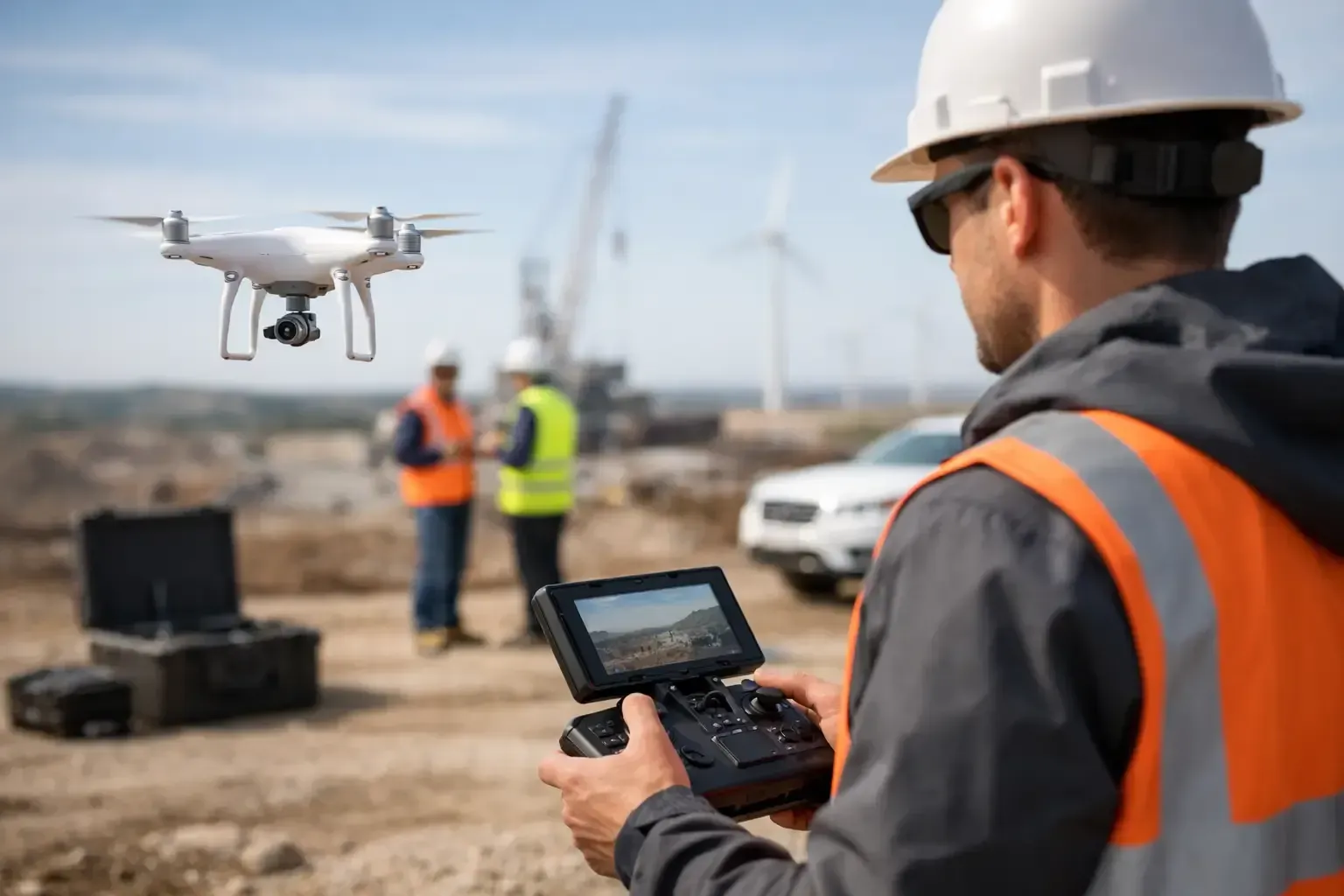
A superintendent standing on a berm can only see so much. On a busy jobsite, that limited view leads to missed grading issues, delayed updates, and progress reports based more on estimates than measured data. Construction drone mapping changes that by turning an active site into a current, measurable visual record your team can actually use.
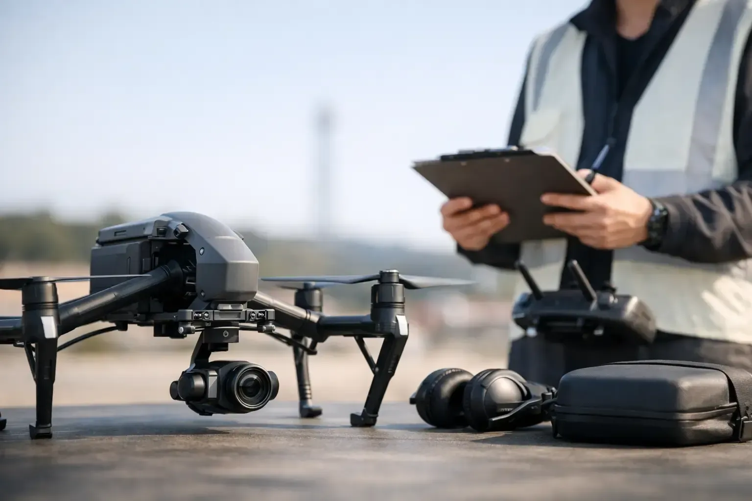
For contractors, developers, and project managers, the value is not just getting nice aerial images. It is getting repeatable site data that supports scheduling, coordination, billing, and risk control. When the mapping is done correctly by an FAA-certified, insured operator with construction experience, it becomes a practical field tool rather than a marketing extra.
What construction drone mapping actually delivers
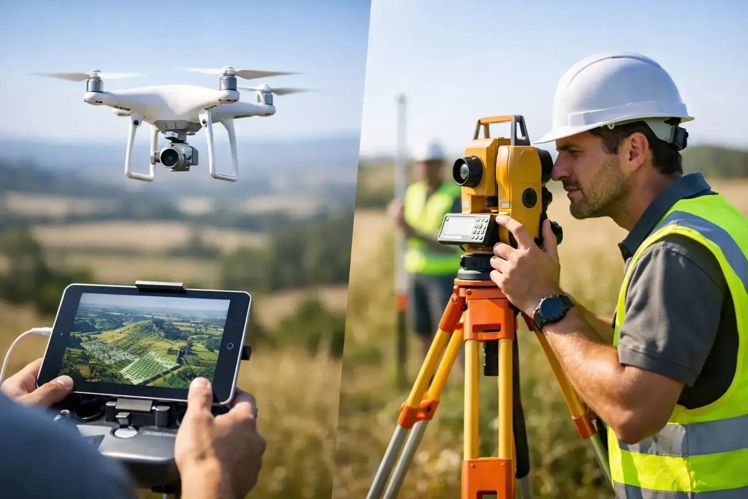
At its core, construction drone mapping uses planned drone flights to capture overlapping aerial images across a site. Those images are processed into outputs such as orthomosaic maps, 3D models, topographic surfaces, and stockpile volume calculations. Depending on the phase of the project, those deliverables can support pre-construction planning, earthwork tracking, utility coordination, site logistics, and owner reporting.
The difference between standard drone photography and mapping is consistency. A mapping flight is built around coverage, overlap, altitude, and ground accuracy. The goal is not simply to show the site from above. The goal is to create data that can be measured, compared over time, and shared across teams.
That matters on projects where small errors become expensive fast. If a haul-off quantity is off, if drainage is not forming as planned, or if site progress is being overstated, the downstream cost can be significant. A current map gives decision-makers something more dependable than scattered phone photos and verbal updates.
Why construction drone mapping matters on active jobsites
Construction projects move quickly, but field visibility often lags behind. Stakeholders are in different places. Owners want updates. Project managers need accurate records. Earthwork crews need to verify progress. Safety teams need to understand changing site conditions. Drone mapping helps close those gaps.
One of the biggest advantages is speed. A drone can document a large site in far less time than traditional manual walkthroughs, especially on projects with uneven terrain, restricted access, or multiple work zones. That speed makes frequent updates realistic. Weekly or biweekly mapping is often enough to show meaningful changes without adding friction to the job.
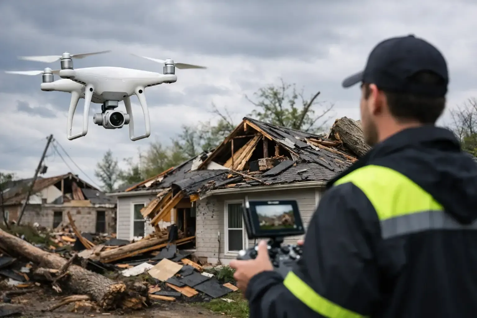
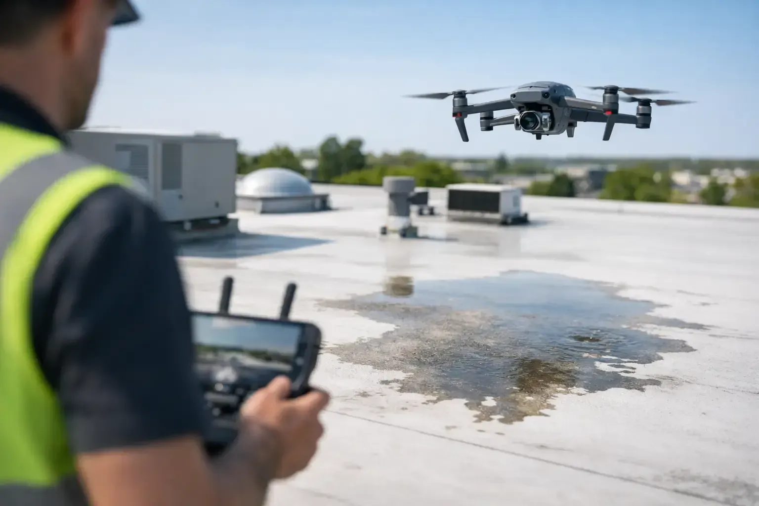
There is also a safety benefit. Some site areas are difficult to access on foot, especially after rain, during grading, or around heavy equipment operations. Capturing conditions from the air reduces unnecessary exposure while still giving managers a clear view of what is happening.
The other advantage is accountability. When progress is documented from the same type of aerial perspective over time, it becomes much easier to verify what was completed and when. That can help with internal coordination, lender reporting, pay applications, and owner communication. It can also help resolve disagreements before they become claims.
The most useful deliverables for contractors and developers
Not every project needs every output. The right deliverable depends on the project type, the stage of work, and how your team already manages data.
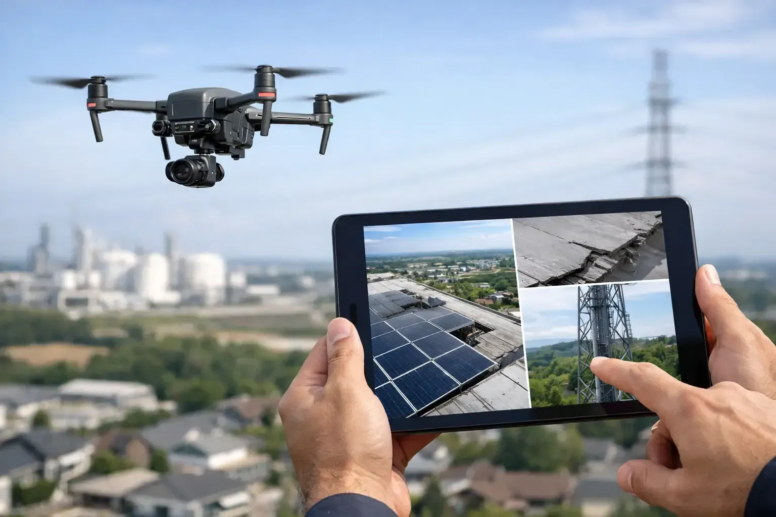
Orthomosaic maps are often the starting point. These are high-resolution, corrected aerial maps that let teams zoom in and review current site conditions with consistent scale. They are useful for documenting grading, access roads, staging areas, stormwater controls, and overall project progress.
3D site models are valuable when surface changes matter. On projects involving excavation, fill, drainage, and rough grading, a 3D model can help teams understand contours and visualize site development more clearly than flat imagery alone.
Volume calculations are especially useful for earthmoving operations and stockpile tracking. If you are managing import, export, or on-site material usage, aerial volume data can support tighter cost control. That said, volume results depend on flight quality, processing quality, and the right expectations. They are highly useful, but they should be collected by operators who understand how to capture and process data correctly.
Progress documentation is the most broadly applicable use case. Many teams simply need a dependable visual record of what changed this week, this month, or this billing cycle. In those cases, mapping can pair well with standard progress photos and video, giving stakeholders both measurable site context and presentation-ready visuals.
Where drone mapping fits in the project lifecycle
Construction drone mapping is not just for one phase of the job. It can support a project from early planning through closeout.
Before construction starts, aerial mapping can provide a current visual baseline of the property. That is useful for documenting pre-existing conditions, access points, adjacent improvements, and site constraints. For developers and owners, this baseline can become an important record later.
During earthwork and site development, mapping often delivers the highest operational value. Grade changes, haul routes, stockpiles, trenching, and drainage patterns can all be tracked more efficiently from the air. This is where frequent updates can save time and reduce surprises.
As vertical construction progresses, mapping remains useful for documenting structural progress, laydown yard organization, equipment placement, and site logistics. It can also help keep remote stakeholders informed without requiring constant site visits.
Near closeout, aerial maps and imagery help document final site conditions, paving, landscaping, and completed improvements. For some teams, these records support turnover packages, marketing, or future property management planning.
What separates useful mapping from a basic drone flight
A drone is just a tool. The value comes from how the operation is planned and executed.
Construction sites are rarely simple flying environments. There may be controlled airspace, cranes, dust, active machinery, changing access points, and tight scheduling windows. An operator needs to understand FAA rules, airspace coordination, and safe flight procedures around active work. They also need to communicate clearly with the site team so the flight supports operations instead of interrupting them.
Consistency matters just as much as flight skill. If mapping is going to be used for progress tracking, the flights should be performed with repeatable methods. Similar flight paths, appropriate overlap, proper altitude selection, and predictable capture settings all improve the quality of comparison from one visit to the next.
Processing quality also matters. A rushed map with poor alignment or missing coverage may look acceptable at first glance but provide weak data when you try to rely on it. That is why experienced commercial operators are typically a better fit than hobby-level providers offering low-cost flights without construction workflows behind them.
Trade-offs to understand before you schedule
Drone mapping is valuable, but it is not magic. The best results come from matching the method to the actual project need.
Weather is one factor. High winds, rain, dust, and harsh lighting can affect both flight timing and output quality. In Arizona and South Texas, that means timing matters, especially during monsoon periods, peak heat, or seasonal weather swings.
Site conditions are another variable. Heavy overhead obstructions, limited takeoff areas, and active safety restrictions can affect what is practical on a given day. Some sites are ideal for full mapping flights. Others may be better served by a mix of targeted imagery and partial mapping.
Accuracy expectations should also be discussed upfront. Some clients need general site documentation and progress visuals. Others need mapping that supports measurements and more technical review. Those are different service levels, and a reliable provider should explain what the deliverables can and cannot support.
Choosing a construction drone mapping provider
If you are hiring for construction drone mapping, look beyond the sample photos. Ask how often the provider works on active jobsites, whether they are FAA-certified, whether they carry commercial insurance, and how they handle controlled airspace approvals if your site is near an airport. Those are not minor details. They directly affect reliability and legal compliance.
It also helps to ask about turnaround time and deliverable format. A polished map is only useful if your team receives it quickly enough to make decisions. Construction teams usually do not need artistic editing. They need organized outputs, dependable scheduling, and communication that fits the pace of the job.
For projects in Phoenix or San Antonio, local operating experience matters too. Familiarity with regional weather, airspace, and jobsite conditions can make scheduling smoother and reduce avoidable delays. That is one reason companies like Phoenix Drone Pros focus on operational discipline as much as image quality.
The best mapping provider is not simply the cheapest flight. It is the one that can show up safely, document the site consistently, and deliver information your team will actually use.
Construction moves on facts, not guesswork. When your site data is current, visual, and measurable, decisions get easier. The right aerial mapping program gives you a clearer picture of where the job stands today and where problems may be forming next.